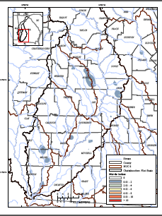
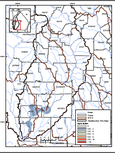
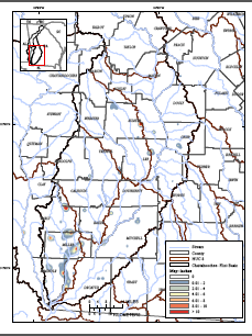
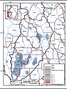
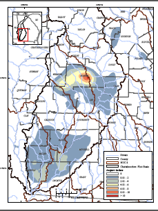
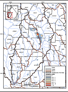
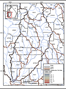
Georgia Agricultural Water Conservation and Metering Program Monthly irrigation depth maps
Metered, irrigation water-use data collected monthly during the 2013 growing season from a 100-site monitor network operated by the Georgia Soil and Water Conservation Commission were analyzed in a geostatistical framework to estimate irrigation depth in the middle-to-lower Chattahoochee-Flint River basin of southwestern Georgia. These geostatistical techniques previously were applied successfully to annual, metered, irrigation-depth data in the study area for the 2007 growing season, and were applied in the identical manner here (see Scientific Investigations Report 2011-5126, listed on the Publications page of this web site). The basinwide maps show monthly estimates of irrigation depth derived from this geostatistical evaluation. Spatial patterning of irrigation depth shown on the monthly maps indicates irrigation of specific crops, for example, increased irrigation of corn during May and June. The geographic shift in the patterns of irrigation rates within the basin during the growing season could indicate increased (or decreased) irrigation of other crops or delayed harvesting of corn due to delayed planting, for example.
Click on a map to view monthly irrigation depth maps in high-resolution PDF format


 Georgia Agricultural Water Conservation and Metering Program